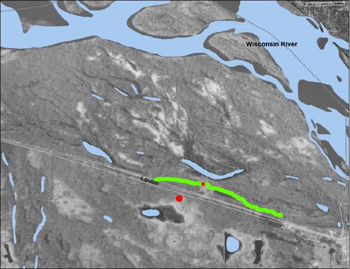
Ok, so here is an aerial of the area. The large red dot is the parking area (for reference)
The green line is part of a levee that is about 10-12 feet higher than the surrounding bottom, and the red dot on the levee is the best access point to the river bottom. So with that little bit of info as a starting point, what areas jump out at you? What direction are you heading first and what are you looking for?