


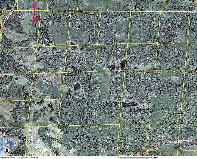
Where would you hunt in this area. Satelite photo inside. Thanks
 11-15-2007, 10:08 PM
#1
Thread Starter
Join Date: Oct 2005
Location:
Posts: 8
Ok, there is a highway that runs the whole west side of the map, and a dirt road that runs the whole south side of the map. This is in Northern Minnesota. Please feel free to ask for any more information. My family just purchased this land and Im going to hunting it this muzzle load season and late bow.
Thank you to anyone that can help; click the link below to view aerial photo
http://i203.photobucket.com/albums/aa174/gmzx7r/Itasca_Internet_fsarcims16604636929.jpg
Thank you to anyone that can help; click the link below to view aerial photo
http://i203.photobucket.com/albums/aa174/gmzx7r/Itasca_Internet_fsarcims16604636929.jpg


