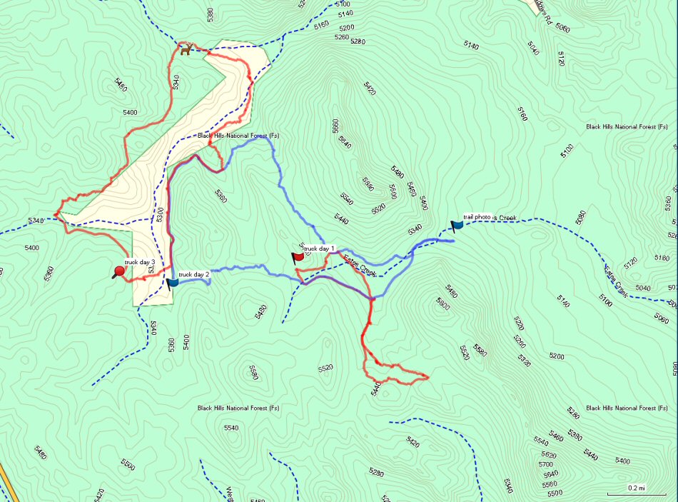
The way point named trail photo kinda center right is where i took the picture of the rocky trail. It is all government land there, and the coordinates are: N44 10.587 W103 33.611. Anyone wanting to drive the trail; fly at it.
The red track to the right i hiked the other day, and the way point shows where i left the truck.
The blue track is the one that took me to the rocky trail, i will never go back. One can see how i back tracked up the trail, and went away from them rocks. The way point named truck day 2, shows where i left the truck.
The red track to the left is the trail i hiked this morning, and is the one i photographed today. It is the photo posted here previously of the lovely trail. What i did was park the truck, and walk where i could have driven, part of the way. It paid off, because i ended up seeing an elk. He can be seen standing right there on the map. Yes, i like leaving those machines behind when ever possible. Somehow, i managed to walk all those miles, up hill, down hill, around dead fall, over dead fall, and never fell down once. Without a walker?
..