I made maps of the hunt club using my gps and a website called gpsvisualizer.com. I'm not sure if it's what you are looking for but here is an example:
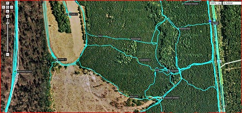
I use the snipping tool to take screen shots of the maps when I am at that website. You can zoom in and out, depending on what detail you need. I don't know if you can tell but the pic has waypoints marked with lables by them.