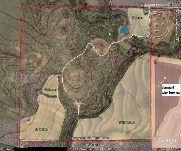
Here's an older version where I put an overlay of a topographical map over the Google Earth aerial image. This also zooms in and out in the same ratio. I pulled the topographical map from a free online service as well, I think it was topozone.com.
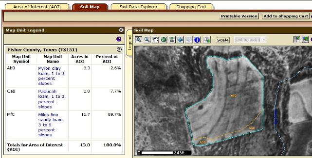
Here's where I use the USDA soil survey information to calculate the acreages. It also gives you the soil types which is nice too.