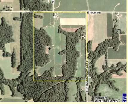
I've been reading alot of articles on scouting here recently and alot of people are talking about using aerial maps for their scouting. I just wanted to see what all some of you would try to gather from a couple aerial pictures of some of the land I hunt.
What exactly would you be looking for?
What do you actually see in these pictures?
Where would you position yourself?
I basically want to pick your brain and see how you read this....What ya got for me?
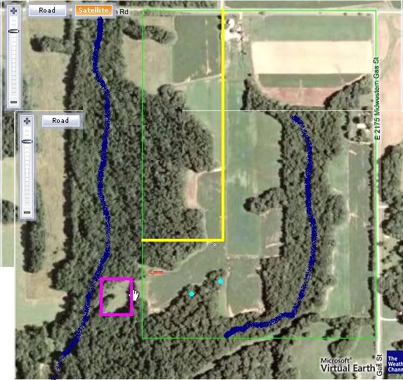
*The fields are beans and in winter wheat right now.
Green Box= Property
Yellow Line= The small segment blocked off by the yellow is already hunted by a couple of guys
Pink Box= Food Plot
Blue Streak= Creeks
Red Arrow= Biggest rub(s) I've ever seen in my life!!
Turquoise Dots= Stands I have up now