Haven't posted much in a while, but I've been busy doing getting down to some scouting and doing some legwork around my property. I'm taking scouting a little more seriously this year and hopefully it will pay off. If anything, I will learn a lot more, and that's really the main goal. So I've constructed this thread to include a map of my property (I will update this when I reach other areas and get to scout them more thoroughly) that will include various notations of sign/terrain features that I find noteworthy. Additionally, I've taken pictures of terrain features and the areas in general that I reference in the map so as to provide everyone here with a "window" into what each location consists of. It may get a little confusing as I add material on to the map and set more reference points, but I'm trying to keep it straight forward.
My goal for this thread is two fold really. I really want input from all of the members here on locations I've scouted, my thoughts, any additional ideas, etc. I also want this thread to serve as a tool for beginners to get a basic understanding of scouting and what features they should be looking for when analyzing a new piece of ground. This thread will be updated as I add more pictures and scout more pieces of land. For the opening thread, I was only able to scout the southeastern and centrall portion of the land.
Ok, here's the map
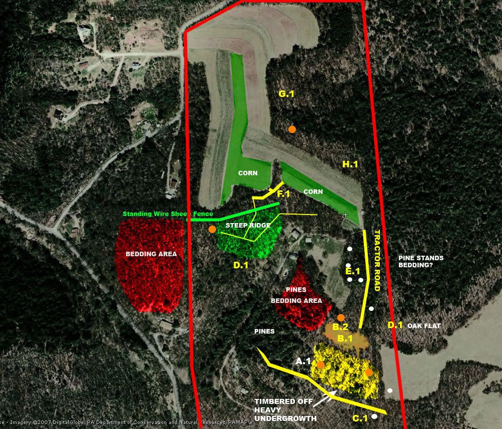
Some basics to the color coding:
The red border is my property line, the yellow lines indicate trails (heavily worn trails were the only ones indicated on my map, it does not mean there are others) except the tractor road which is also identified in yellow.
The orange dots are my 2007 stand locations
The white dots are 2007 sign I found while scouting POST-SEASON
The highlighted areas all indicate some sort of generalized area and are labeled as such
The lettering system (A.1, A.2, etc) is used to reference locations with the pictures I will be attaching below.
West, North, East, and South are in their normal orientation on this map.
NOTE: D1 is on there twice. I will edit this when I update the thread again with more pictures. For now, when I reference D1 on my scouting log below, I'm referring to the D1 identified on the eastern portion of the property.
OVERVIEW OF THE PROPERTY:
LOCATION: NORTHCENTRAL PA
PREVAILING WIND DIRECTION: W/NW
SIZE: 90 Acres
AGRICULTURAL FIELDS/HARDWOOD/SOFTWOOD MIX
Ok, on to my first stand site:
A.1-
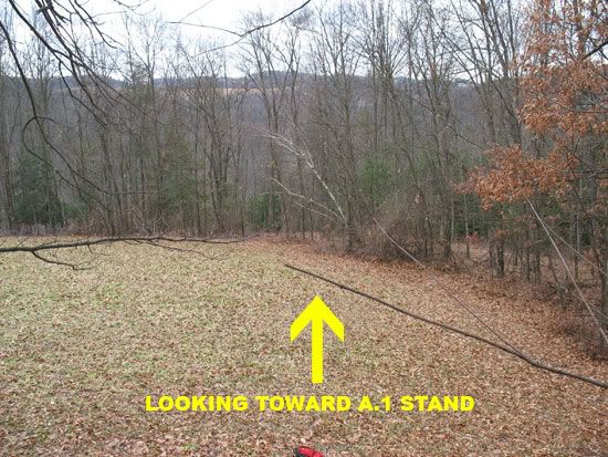
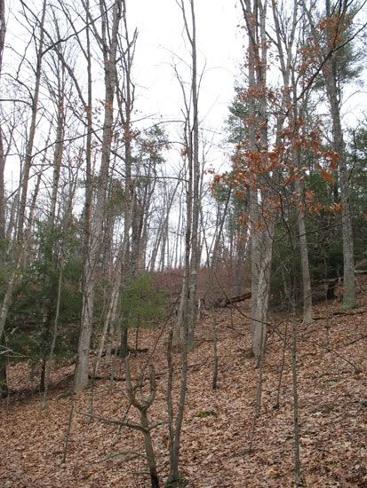
This site was chosen because it sits right outside the edge of that pine thicket to the west as well as sitting just south of my food plot (which is B.1). The pine thicket is used as a bedding area, and was a very effective morning setup as I often would catch does slipping back into the thicket from the east around 8-9am. However, this stand wasn't the best evening stand, as I only every had two sittings where I had deer sightings. One of those nights I did draw back on a nice doe, but my peep twisted and I had to let back down. Anyways, this stand, to me, doesn't make the cut for 2008 for a few reasons. One, the lack of sightings. Two, there's really no terrain feature that would funnel the deer to me. One MAJOR plus to this stand is entry/exit routes. This stand is a mere 80 yds from my backyard (notice the house to the southeast?). I have a very worn trail (from the logger) that I can sneak right into the stand, and since much of the walk is in pines, the ground is softer and quieter. I was NEVER busted here. Here's a picture of the area:
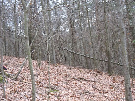
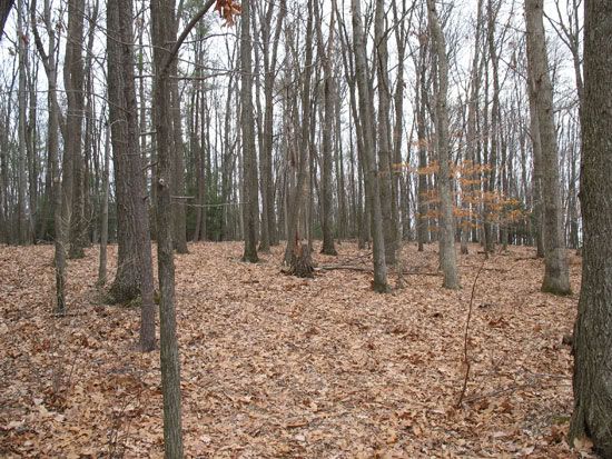
This is actually standing at the base of the tree my stand was in looking west into those pines. You can faintly make out the logging road winding up and to the right of the picture. This road leads to the food plot indicated as B.1 on my map. Here's another view of the thicket:
Now, on to the food plot:
B.1-
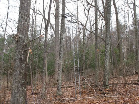
This is an ~.75 acre plot we've had established for quite some time on our property. We've planted a wide variety of foods in here from corn, clover, buckwheat, rye, and now turnips/brasicas. This plot took of this year, but was UNTOUCHED throgout the season. I attribute this to the large acorn crop we had again this year. However, once the food supplies began to dwindle and we had a few hard frosts, the deer are tearing this turnip plot apart. They started out eating the tops off, and are now pawing the turnips up and eating them. The only question I have about this area is if maybe I should plant something as a mix next year that will provide a solid late summer/early fall food as well as a early/late winter forage. Any ideas here? My stand location is labeled as B.2, and I hunted it only a handful of times (all evenings), and never saw a deer. Sawy plenty of turkey's in the area, however.
B Area Pictures:
Picture from up in the stand:
Now, on to the "C" area:
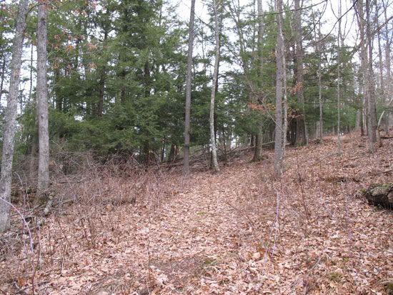
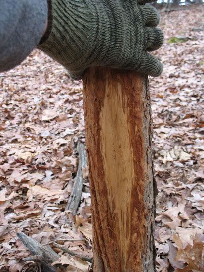
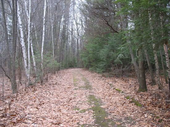
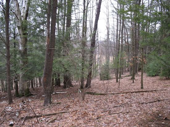
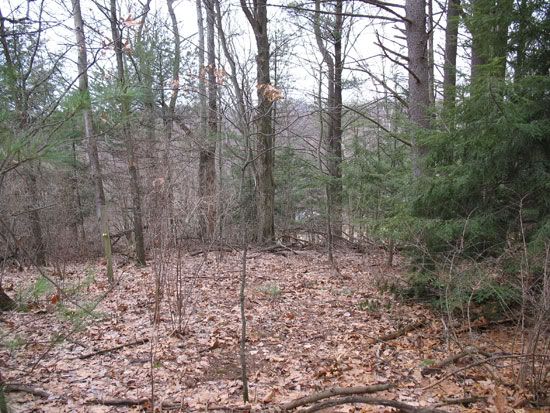
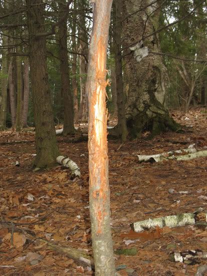
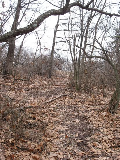
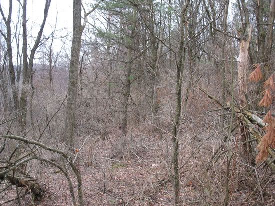
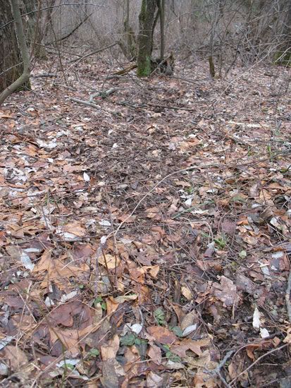
Ok, you will notice the yellow highlighted area in this portion of the map indicating a timbered region. We had this timbered off about 6 years ago, and left the tops in to spur regeneration. This area has grown up in to some very thick habitat. I hunted the 2007 season in that area indicated by the orange due directly east of A.1. This spot yielded no close deer sightings, but I did see deer regularly come out in the field directly east and off my property line. This is the stand where I almost grunted in a nice 8point the second to last weekend of the season. C.1 on the map is a bit further south of where my stand was this year and was where I did a lot of scouting. Here's my observations: C.1 is located right along a seam of a draw with an abundance of white oaks. There's a very worn trail (indicated by the thick yellow line) that runs across from the west to east PARALLEL with the thick timbered off overgrown area (indicated by highlighted yellow). The trail goes into a thicket to the east of C.1 (off my property) and runs west all the way toward my A.1 stand. I picked this spot as potential stand location for next year to to the Oaks, the obvious trail, the funnel created by the thicket and the nearby bedding thicket off my property. My only issue with this location is entry and exit routes? I also found a VERY nice rub right along this trail. Pictures:
This is a picture standing right near C.1 and looking East (off my property line). This is where one end of the trail goes.Very thick and overgrown.
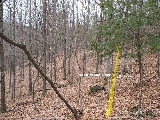
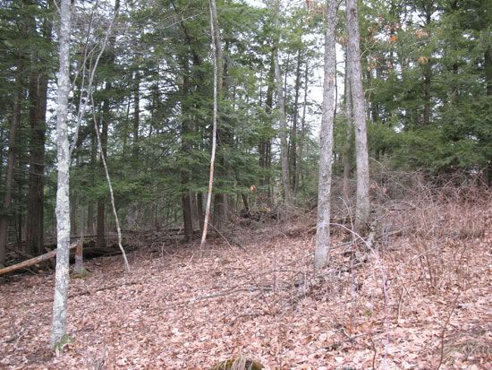
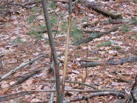
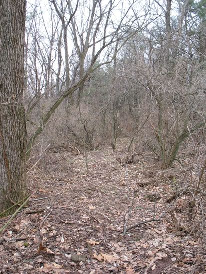
This is me looking west at C.1. This shows the trail's general direction. You can make out how the land starts to curve back upwards after the seem. It's a subtle draw, but it's still interesting. I've also indicated the rub in this picture, but here's a close up:
Here is a picture of some Oaks right near where I want to place my stand here at C.1:
This picture here ^^ gives you an idea of the slope of this hillside...it's very steep. The trail I indicated in this area is almost so worn and used it's a small "ledge" cut into the side of the hill. Any thoughts on this location? Ideas for entry and exit routes?
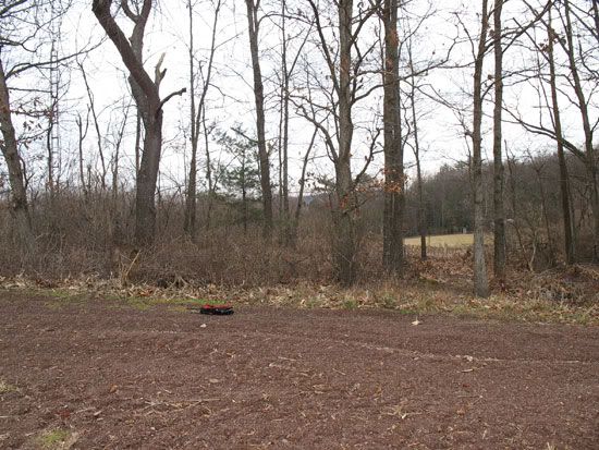
Ok, now D.1 is off my property line, but it's close enough to my food plot and my E area that I wanted to mention it.
D.1-
This area is just off our property line but is easily the most flat, mature oak group that is near our property. Turkey's are in here ALL of the time. However, I'm not sure if it's close proximity to my food plot and potential bedding areas off my property are keeping deer in here rather than my food plot which would have accounted for the lack of sightings this year. Thoughts? Here's a picture of the flat:
Now, on to E.
E1-
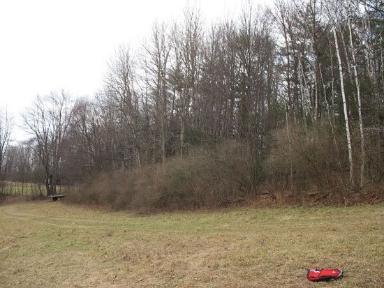
E1 is an area new to me in terms of considering hunting. This is a small piec of ground made up of mostly pine/hemlocks and some white birch (a few oaks) that is flanked on on side by our pasture (to the west) and a tractor road and thick pines (to the east). When we still had horses, we had a fence running the whole length of this chunk (north to south) about midway through. I took the fence down last year, and since then I would see deer coming out of this area into the pasture ALL of the time. I just never thought of hunting it, because it really isn't a "ideal" looking location. We had a few nice snowfalls this year, and after each one, I walked down the tractor road (from south to north on the map) and looked for where deer were crossing the road into this area. Once I did, I followed the tracks through this chunk and sure enough, once inside this piece of land, there were tracks EVERYWHERE. Tracks, droppings, rubs, and scrapes. But why??? Can anyone look at this area (E.1) and tell me why deer are traveling this lengthwise and coming out both ends (both in the pasture and up toward the corn fields in the north?). This area has the MOST sign I've found all year and will be on the stand site list for next year, I would just like some insight on why deer are using this? Here's some pictures to get a better understanding:
This is looking from south to north on the tractor road. To the left is the E.1 area, to the right is the thicker hemlock/pine area (our property line is not far off this road).
Inside the E.1 thicket. This gives you an idea of the composition of the thicket. Mostly pines/hemlocks, fairly open. You can make out the corn field to the north in this picture. This picture is also facing from south to north.
This is about midway through E1 thicket. It transitions from overgrown saplings/jaggers into the pines/hemlocks. You can see a fence post in this picture (left hand side).
In addition to all of the FRESH droppings/tracks I found in here, I found numerous rubs.
Ok this picture ^^ is taken in the pasture looking at the outside of E.1. Notice the corn field to the left of the picture. This is the pasture that flanks E.1 on the west side.
Now, on to F.
F.1-
This area caught everyone's attention on HNI this past fall when I posted a photo of my property. It's essentially what is looks like. A small finger protruding into a corn field (with corn on both sides). I never hunted this area this year because of on major problem. Right at the point of the finger, we have the tractor road that winds through our field. We have neighbors who we allow to walk through here (should only be the summer), but of course, they walk dogs without leashes, and walk all through the season, so deer movement is seriously affected. I will be posting our property with walking "regulations" this year and letting neighbors no there will be no land usage from mid-august through January. Anyways, I cut a path in this area (indicated by the THICK yellow lines). This area is being WELL used right now (tracks all over the place). The thin yellow lines are natural trails I've found winding this area. There's also and old standing (mostly) sheep wire fence that runs the length of the ridge and is down in one spot. This spot is being used as a major crossing for deer coming up off the ridge and then joining up with my man-made trail which then diverts them into one of the two corn fields (the one to the east of the finger or one to the west). I'm thinking of placing a stand RIGHT where I have F.1 labeled. The fence is a natural funnel obviously, so is the ridge line. Below the fence on the sloping ridge is absolutly thick and I KNOW they bed in there, so essentially I'm setting up a combination of man-made and natural funnels near a food source. The corn is ALWAYS standing through archery season, so that's not a huge issue if I can pinpoint where they're entering. The green highlighted area in this area is not only extremely steep but it's a bedding area (as I've indicated a dew lines up). Here's some pictures to give you a better understanding:
This is taken RIGHT where F.1 is labeled on the map. This is the trail I made, specifically the portion that runs into the eastern portion of the corn field. I'm standing faceing the lower corner of the corn field that is EAST of the finger.
I'm at the same spot in this photo, just spun around facing to the WEST. This is the other portion of my man-made trail. The corn field would be to my immediate right in this photo. You can see why my trail made for a funnel, due to the thickness of the growth on both sides of the trail.
For this photo, I walked down my trail a ways toward the fence/ridge area. This gives you a sense of how thick it gets closer to the ridge/fence line.
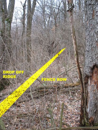
This photo was taken at the point where the fence is down right along the ridge. I'm facing to the west here, and outlined the approximate height of the fence, since it's very hard to make out (rusty square weave fence).
You can make out the fence better in this picture and note that it's down here. See the ground all tracked up? It's obviouse they're crossing here as they make their way into the fields. A man-made pinch point. You can get a sense of how thick and steep the ridge is here in this photo as well. I believe they're bedding down in here, as I jumped a handful when I went in to scout yesterday.
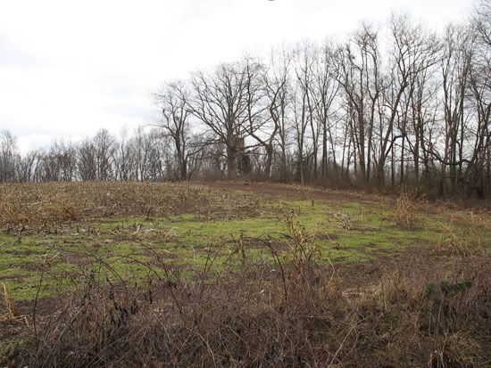
This is the entrance STRAIGHT UP from the fence crossing. They seem to be coming out here as the main entrance on this part of the field. Here I'm looking east toward the finger that sticks out in the field. Notice the lack of corn growth in the first few rows (this year was hard on our corn).
This picture was taken standing in the corn field to the west of the finger looking through the finger to the corn field on the other side. This gives you a sense of how thin the finger is.
Ok, that's it for now. I still need to scout the areas of H1 and G1 yet, as well as D.1 (which was put on there as a typo, that should be I). However, like I said, this thread will be an ongoing project for me (unless you all think it's a waste of time

), and will update it accordingly. Again, I just want some feedback on some of my specific obeservations so far, whether or not I'm off, missing certain things, overlooking key points, etc. My stand locations are not established in stone for 2008, but I already have a better idea of where I want to setup so far. Scouting this time of year is the BEST. No leaves on the trees, no bugs, very easy to see sign (especially with snow), and no worries of effecting deer patterns for the fall. I've NEVER scouted this early, but it's already showing me things I never would have found if I would have waited until summer. So, hopefully this thread helps shed some light on some basic scouting for beginners, and hopefully you HNI guys who know much more than me (I think that may be everybody on here
) can help me out with any pointers, advice, etc.