The questions was ask how do you read these maps. Here is what I look for, maybe Gregh,Greg/Mo, Buckeye, Roband others can throw in there .02 cents.
What I look for are changes in the terrain, choke points, inside edges(in the woods), inside corners, escape routes, North and South Trails.

North is straight up
The above is north side of the property I hunt. We can see some fence lines and some really good choke points right off the bat.
Also in the wood lot you can see a "break" in the trees. I have it mark in red below. This is what I call an "inside Edge" and is a great place to start to look when you scout on foot.
What I look for in a Bedding area is
1.Cover
2.Accesibilty
3.Access to food and water
4.Escape routes.
4 is the key for mature bucks(IMO), a mature buck is NOT going to back himself into a corner.
The bedding area here has all 4, but the issue with both these area's are so thick you can not hunt them. So I look for trail a buck might use. This is where I look for a seldom used North to South trail. Why? The wind is from the W-SW most of the time. During the Rut a buck will scent check a bedding area and he will scent check it before he goes in the early season. A lot of times he will run a trail to check, if the wind is coming out of the west, he might use this trail to crusie through and check. On this spot we have a great "trail" that does this. Marked in red(same as break we can see), the entry trails to this bedding are are marked in Yellow. Now Even though for this location there is not a "main" trail in or out. I can hunt the bedding area by hunting this 1 trail.
Thishelps withnot spreading my scent around by have 2 or three setups in this small area.
recap I look for
1.Choke points
2.Break inthe woods(inside Edges)
3.Access to food and water from a bedding area
4.Escape routes for a buck.
Below is the map I have marked up. Blue is the stand location. Yellow are the entry trails for the bedding area.
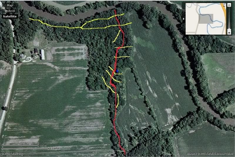
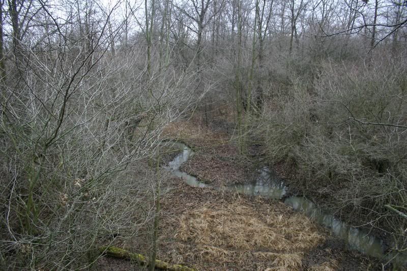
Here is the stand, you can see the gully, which is the break in the woods you can see on the map, marked in red. Now look at the top map and you can see the break. I hunt here because this is where the funnel comes in. The bank in the east side isclose to the back on the west side.The trailthen runs dead north past this point. Which is the THICKEST part of the bedding area, and right in the middle.
That is whatI do, sometimes it works, and sometimes it does not!