ok lets assume you've never hunted ELK, and you just stepped out of the truck,
you've got a topo map of the area and you have a compass and ideally a gps
step one, you need to pack your back pack, make sure you have the licences, and gear you think youll need and the boots clothing and gear you expect youll need, keep it light ,
you first step is locating or scouting the area and getting some concept of the area your dealing with,break out the topo map and locate where your truck is parked on it.
locate the logging or access roads and if there are any marked trails,
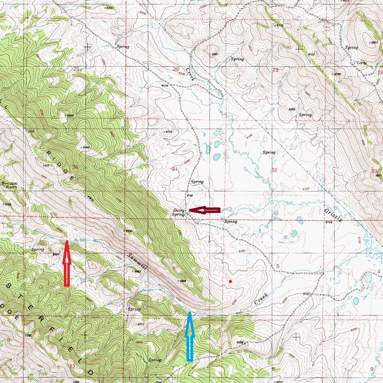
lets just for giggle use this topo map, notice theres compass directions, locate your current location on the map,your going to need to relocate camp and the truck at some point so you need to know what compass directions the ,
canyons and roads are in relation to where you intend to hunt.
look closely at the map, notice every so often theres a number like 6700, or 6200 on the lines, these are elevation numbers, the lines on the map are each at a specific elevation
lets assume your truck is parked on a logging road or trail, and you locate your location, follow the elevation lines, lets assume your parked at the spring where I placed the dark red pointer arrow, your parked on a rolling incline and too your south-west is a lot of closely spaced lines this indicates a steep incline, or ridge that juts up or canyon between you and moving directly to the south west, reading the elevation numbers and comparing those to the area your parked at will indicate if that incline is going to be upward or downward from your current location,
generally roads follow ridge lines (higher elevations or rivers lower elevations) some follow contours , its your job to locate your camp, then its relation and location compared too the surrounding lands contours. notice too the north east theres fewer contour lines, this indicates fairly level meadow or open areas, if its shaded on the map its more likely covered in trees and brush.
ITS hard to read this posted map but lets assume your at about a 6700 ft elevation,and too the southwest is sawmill creek at about 6200 ft elevation, that means theres over 500 feet in drop walking into that canyon, and about the same change in altitude walking back out if your route is directly south west,
notice the slightly darker tan contour line, denoting your current elevation, follow it south east then back to the north west into sawmill creek, and you may find easier walking
 those lines on the topo map indicate about 20 meters in change in elevation between any two lines
 the closer together the steeper the grade
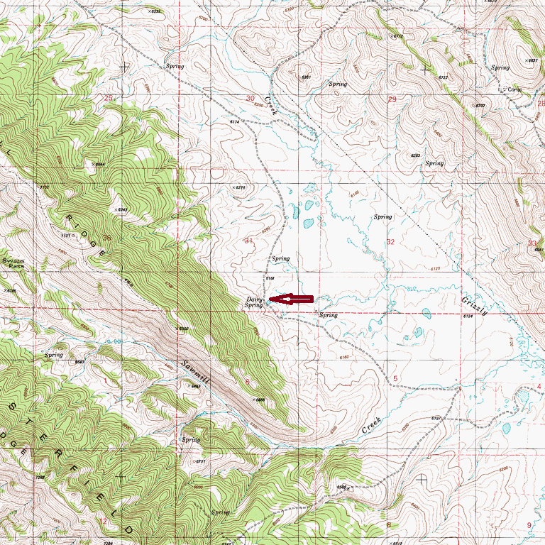
there will be natural travel choke points like steep grades and canyon walls the blue and bright red indicate potential travel choke points.
obviously if you can find a place to easily glass those two choke points, game will need to find water and the creek supplies that, many topo maps are shaded indicating vegetation
having a topo map you can read and if you can find any recent Ariel photos helps increase your chances of scoring.
the idea here is to use your ability to glass the area to locate game, youll exhaust yourself if you try to walk the area extensively, but if you locate a ridge you can sit on and watch a terrain choke point you can in theory control with a rifle your odds increase, game generally trys to follow natural contours and would prefer to avoid trying to climb steep grades if not being pushed, as you gain experience in an area take notes, talk to your friends about what they saw.
game prefers area with feed and cover, its your job to locate the areas game uses and think of ways to avoid thermals and being spotted visually or have your odor reach the elk., before your well inside your rifle and your personal skill limitation on making an accurate shot.
easy access to any area from a drive-able road is frequently a strong indicator that game will tend to avoid those areas, as hunters will look for easy road access,
game will look for feed and cover in areas with good cover and
less easily accessed areas, that provide cover and food & water,with less hunter easy access,
thus over time travel patterns over wide areas will form,
but keep in mind elk can and do travel many miles every day, your particular canyon or drainage may not hold any elk one day,
and hunter pressure else ware can and will alter movement. herds will move between several drainage's or canyons.
finding a spot that allows you to glass and control or deny access by game with your rifle,
through several natural terrain choke points is a smart route vs aimlessly wondering ,hoping to see elk,